Discovering Ontario’s Parks of the St. Lawrence – Camping Along the Long Sault Parkway
By Ben and Cheryl Coles
Since the inception of Camping with the Coles back in 2019, our viewers have been suggesting places for us to visit and review. Some have suggested the Parks of the St. Lawrence. Before then, we’d never even heard of them! After a bit of research, we were convinced and made reservations for three campgrounds, two of which are along the Long Sault Parkway: Woodlands Campground on Woodlands Island and McLaren Campground on McLaren Island.
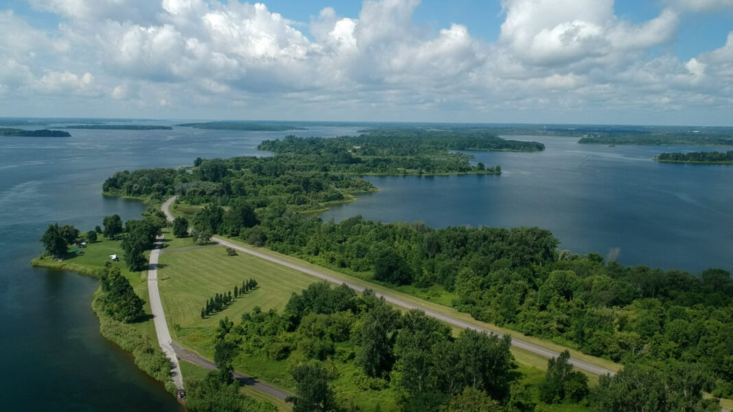
Cheryl and I were immediately struck with how beautiful the views were as we turned onto the Long Sault Parkway from the town of Ingleside. If you’re using Android Auto or Apple CarPlay for navigation, we recommend using Google Maps in satellite view. This allows you to really see an aerial view of the series of islands that stretch out before you and adds that little something extra to the experience.
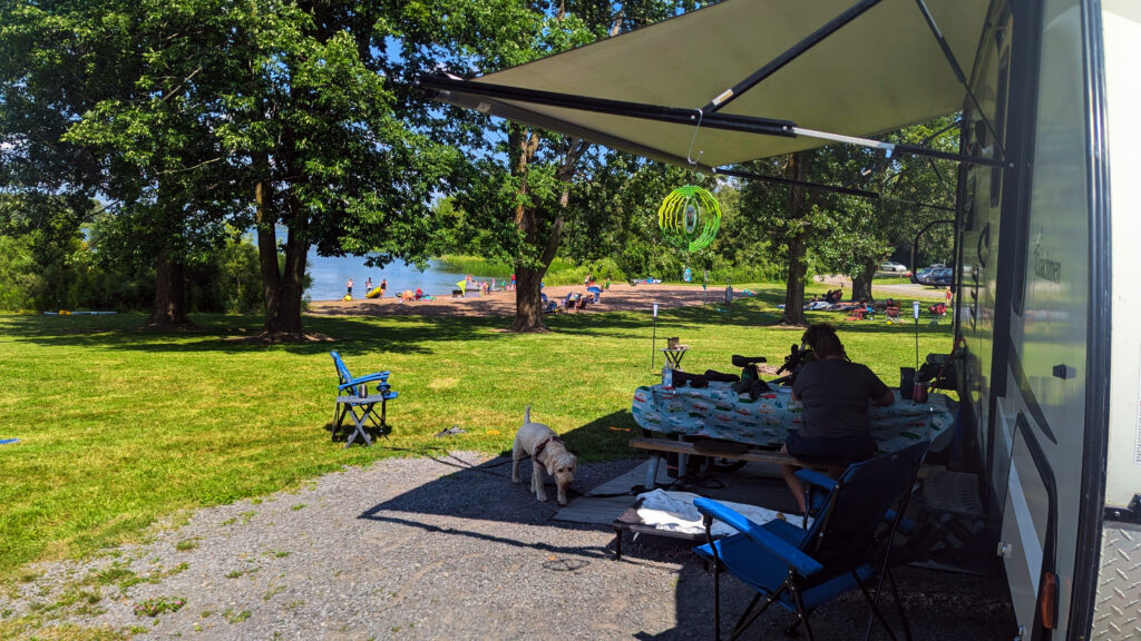
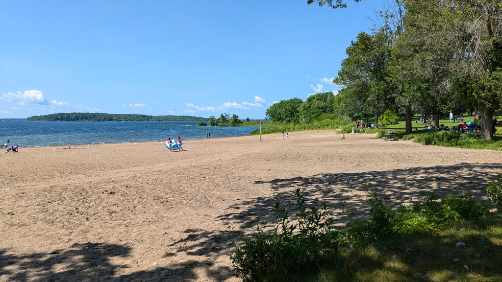
Our first stop for three nights was Woodlands Campground, which is located on the inland side of Woodlands Island. On the opposite side of the island, the St. Lawrence Seaway side, is the public beach looking out towards New York State. Woodlands Campground has 193 campsites with 30 sites with 50 amp electric and water hookups, 92 sites with 30 amp electric and water hookups, 5 sites with 15 amp electric and water hookups, and 66 unserviced campsites. There are also two mini cabins and a family lodge. We had a 30 amp with water campsite with an unobstructed view of one of the two campground beaches. The sites are quite open with little tree cover and very little privacy, however it made an excellent base of operations to explore the Long Sault Parkway and surrounding area.
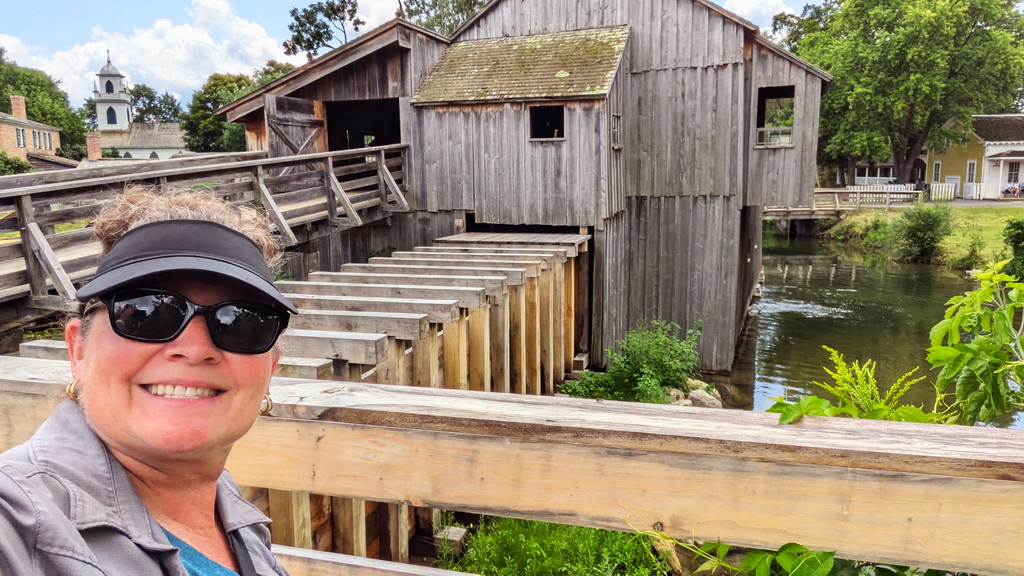
Our first stop outside the park was The Lost Villages Museum which is located 12 km east of Woodlands Campground, just outside of the town of Long Sault. This outdoor museum consists of ten buildings that had been moved and restored from the Lost Villages and surrounding townships. At the museum we learned that The Lost Villages are three hamlets and six villages that were part of the 58,000 acres (235 square km) of land that was intentionally flooded to create the St. Lawrence Seaway. For more on the Lost Villages Museum, please visit https://lostvillages.ca/
Over a one-week time period, starting back on July 1st 1958, the newly built Moses-Saunders Power Dam was opened for the first time, to raise the water level of the Long Sault Rapids by 85 feet in order to allow large cargo ships to travel down the St. Lawrence River. A series of 11 islands, which would make up the Long Sault Parkway, are the hilltops of the flooded lands. The road and the campgrounds opened in 1958 and beaches opened soon after in 1959. Leading up to the flooding of the lands, approximately 6500 people were displaced, having their land expropriated. They were moved to the newly created towns of Ingleside and Long Sault. We were able to tour the buildings and learn all about the area’s interesting history. Our dog, Jax, came with us since dogs are allowed on the property (but not in any of the buildings).
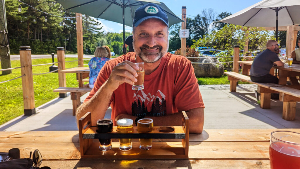
Next up for us was the Lost Villages Brewery, located 3 km west of the Lost Villages Museum, to sample some local brews. This is also a dog friendly place, so Jax was able to sit on the outdoor patio with us. The brewery has an indoor area and outdoor area with picnic tables and patio umbrellas. There is also an area on the lawn to play cornhole. I got a flight of beer and Cheryl, not a beer drinker, had a Floating Church Raspberry Sour. I passed on the IPAs and instead enjoyed some excellent lagers and pilsners. Turns out the raspberry sour isn’t Cheryl’s thing, so I had to man up and finish it for her. Turns out, it’s not my kind of thing either – oh well! I picked up a 4 pack of Faran’s Lager before heading out to our next stop.
The great thing about Woodlands Campground is that at check-in they give you two free tickets to be used at Fort Henry in Kingston or the nearby Upper Canada Village. So naturally our next stop was to use our free tickets at Upper Canada Village, 12 km west of Woodlands Campground. The general admission price in the summer is $25 – so we saved $50! Jax tagged along here too but like the Lost Villages, he wasn’t allowed in any of the buildings. Upper Canada Village transports you back in time to the 1860s with over 40 historic buildings that were relocated from various parts of Ontario and from the Lost Villages, to form this town-like tourist destination. You can interact with costumed interpreters as they show you their trades and crafts such as blacksmithing, baking, farming and weaving. Some of the shops are working shops such as the bakery that makes bread and the dairy that makes cheese. You can purchase some of these items on their own or you can do what we did by going to the café and ordering a grilled cheese sandwich made with village bread and cheese and washing it down with some fresh squeezed lemonade.
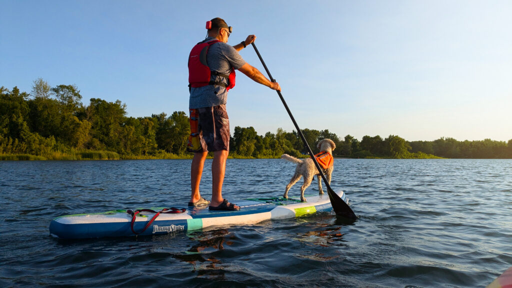
Back at Woodlands Campground, we relaxed at the beach and swam, enjoyed some kayaking and paddleboarding on the St. Lawrence River, steps away from our campsite, and we made some new friends. All in all, it was a great experience.
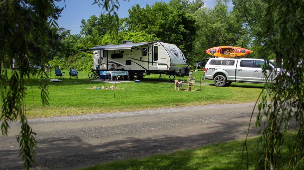
McLaren Campground was our next stop, a whopping 1 km drive away down the Long Sault Parkway. Needless to say, it was a pretty stress-free drive. Upon check in, we were given two more tickets to be used at Upper Canada Village or Fort Henry. This campground is on the seaway side of McLaren Island, looking toward New York State. It’s a great place to watch the big cargo ships go by. McLaren Campground has two campgrounds with a total of 204 campsites. These consist of 81 rustic campsites, 91 campsites with 30 amp electric and water, and 32 campsites with 50 amp electric and water. There are also 8 cabins with electricity but no water, two of which are dog friendly. We stayed at campsite 44 with 30 amp electric and water, and a view of the seaway.
Directly across from our site was water access, which looks like a small beach but it’s not meant for swimming as it’s pretty weedy. It’s an ideal location to launch canoe’s, kayaks, and paddleboards, and let dogs go for a swim. We ended up using it like a beach, sitting in our chairs and letting Jax play in the water with other dogs. Similar to Woodland’s Campground, this campground was fairly open with very little privacy. But it was a nice change of scenery as we continued to explore the area around the Long Sault Parkway.
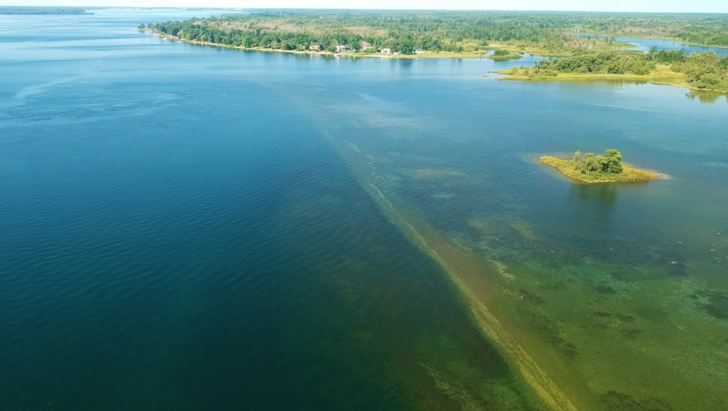
Our first outing from McLaren was to MacDonnell Island and Lock 21 – it did not disappoint. This is a lock that was in use prior to 1958 and the flooding of the area and is now a popular location for SCUBA divers. As we arrived, we saw several SCUBA divers walking out of the water with all their gear. They had just been exploring the Lock which was in shallow water that quickly hits a steep 60 foot drop off, where there are building ruins to explore down below. I was given prior written permission from the park to fly a drone, so this was a perfect time to send it up. The view was amazing. The islands stretched out before us and the Lock was easily identifiable in the shallow water, as was the drop off. Unfortunately, I couldn’t see any of the ruins because they were too far down. But a very interesting thing that can really only be noticed from an aerial view is the old Highway 2. This fairly straight road can be seen underwater and, in some places, above the water. On MacDonnell Island where the highway comes out of the water, they use it as a boat launch.
A few days later we went to the Upper Canada Migratory Bird Sanctuary which is another one of the Parks of the St. Lawrence. I put the drone up there and again could easily see the old Highway 2 under water in that area. Curiosity got the best of me and I paddled out to it with my paddleboard and Cheryl in her kayak. About 100 meters from shore, from my standing point of view, I could see that I reached the road. Cheryl, in her kayak and her low perspective, had difficulty seeing it. I hopped down from the paddleboard and found the road only down about 3 feet. So, I went for a walk on the road where not many have walked in the last 66 years. It was definitely a unique experience.
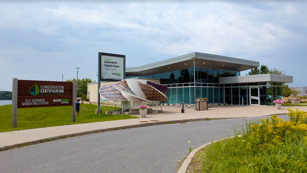
Another place to check out to really understand the history of the creation of the St. Lawrence Seaway and the subsequent creation of the Long Sault Parkway, is the Saunders Hydro Dam Visitor Centre in Cornwall. It’s about 23 km east of McLaren Campground. The entire place is dog friendly and admission is free. We did a self guided tour inside the building with interactive displays, videos, photos and exhibits all showing the history of creating the seaway in 1958. Outside, there is a path that takes you to outdoor exhibits and a view of the dam. It’s a very interesting place to visit and it gave us an appreciation for the area.
We had a great time camping in and exploring the Long Sault Parkway and the immediate area for the first time. It’s like no other place in Ontario. Even if you’re just passing by the area along the 401 heading to another camping destination, I would highly recommend taking a small detour and driving this scenic stretch of highway called the Long Sault Parkway. There are no tolls, and you won’t regret taking the extra time. If you’re looking for a camping experience that is something in between a private park and a provincial park with loads of history to explore, check out the Parks of the St. Lawrence.
Watch the VIDEOS…
Woodlands Campground Review
McLaren Campground Review
Upper Canada Migratory Bird Sanctuary Campground Review

Ben and Cheryl have a column in each of the RV Lifestyle Magazine issues and on the website at www.rvlifemag.com, but they have so much more to share with readers – please take a few minutes to visit their website at www.campingwiththecoles.ca
Ontario Park Reviews
Interactive Park Maps
RV DIY Videos
Gear Reviews


